City & Topo Map Generator for Laser Engraving
Create laser-ready city, topographic, and bathymetric contour maps with OpenStreetMap geometry, NOAA BlueTopo coverage, and separated production layers.
How do you make a city map file for laser engraving?
Search for a place in Map Maker, choose streets, water, topographic or bathymetric contours, and export layered vector files with each feature on its own laser pass. Map geometry comes from OpenStreetMap; contours come from global terrain data and NOAA BlueTopo bathymetry where it is covered. Previews are free and the first export of a map costs 2 credits, with every other format for that map included.
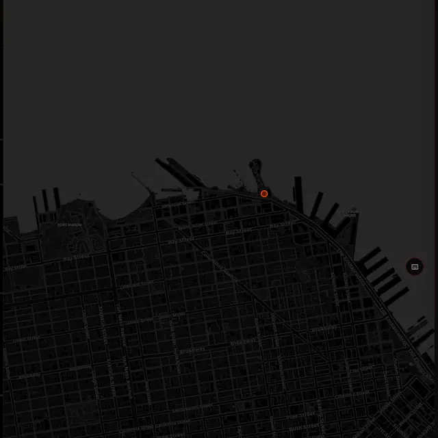
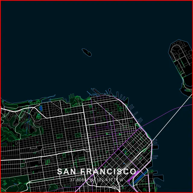
Map Maker at a glance: inputs, outputs, limits and cost
| Input | Any place or map area you search for |
|---|---|
| Data sources | OpenStreetMap geometry; Mapzen global terrain for topography; NOAA BlueTopo bathymetry where covered, with a NOAA ETOPO1-based fallback |
| Output | Layered SVG, DXF, LightBurn .lbrn2, registered bed tiles, PNG previews and decorative shoreline-board packs |
| Cost | Previews free; 2 credits for the first export of a map, other formats and re-exports included |
| Account | Sign in (a free account works) to generate previews and exports |
| Limits | Bathymetric contours are engraving artwork, not navigation data. Decorative Stack boards create visual depth; they are not surveyed depths. |
What does Map Maker engrave?
- Converts open-source geographic data into layered, laser-ready vector paths.
- Generates clean SVG, DXF, tiled packs, and pre-compiled LightBurn (.lbrn2) project files.
- Topographic, bathymetric, or combined contours with automatic or fixed intervals.
- NOAA BlueTopo bathymetry where covered, plus a global relief fallback.
- Separate minor and index-contour laser passes with source metadata.
- Decorative Stack mode exports geometric shoreline-inset boards for layered wood charts.
- Parametric framing options with circular, square, and custom frame designs.
What Operators Say
“I love this software!”
“This is the easiest I have seen.”
“Reticle Red is becoming one of my favorite software to use. It has a lot of tools that many others do not, and approaches things differently to create more consistent results. A++”
“Reticle Red definitely takes the guess work out of your design work with tutorials to walk through the process. I highly recommend it.”
Open City & Topo Map Generator for Laser Engraving — Free to Start See Real Results →
Related Tools & Guides
Frequently Asked Questions
Where does the map and relief data come from?
Map geometry comes from OpenStreetMap. Topography uses the Mapzen global terrain mosaic; bathymetry prefers NOAA BlueTopo survey tiles where covered and falls back to the global NOAA ETOPO1-based relief baseline.
What files does Map Maker export?
Layered SVG, DXF, LightBurn .lbrn2, registered bed tiles, PNG previews, and decorative shoreline-board packs, with map and relief passes separated for independent power and speed.
Are the bathymetric contours navigation data?
No. They are source-aware engraving artwork. Map Maker shows source, datum, resolution, coverage, and available uncertainty, but the output is not for navigation.
What is Decorative Stack mode?
It exports nested geometric shoreline-inset boards for a dimensional wood chart. Those boards create visual depth; they do not represent surveyed water depths.
Does Map Maker cost credits?
Map previews are free. The first export for a generated map costs 2 credits; every additional format and re-export for that map is included.
How is Map Maker different from other free map generators?
Map Maker generates real topographic and bathymetric contours from NOAA BlueTopo survey data and a global relief baseline, not just street and building outlines. It separates minor and index-contour laser passes, supports Decorative Stack shoreline boards for layered wood charts, and exports at up to 4K resolution with parametric circular, square, and custom framing. Free generic city-map tools elsewhere in the field have not publicly evidenced contour, bathymetric, or NOAA-sourced data on their own product pages as of this comparison.
Privacy Policy| Terms of Service| Refund Policy| Contact and Support